How it works
Point and shoot
Hold your phone up to the view and take a photo, as you would with the camera.
It reads the skyline
View Scanner works out the skyline you should see from where you're standing, from detailed height maps, and matches it to the hills in your photo – far more precise than a compass alone.
Tap to explore
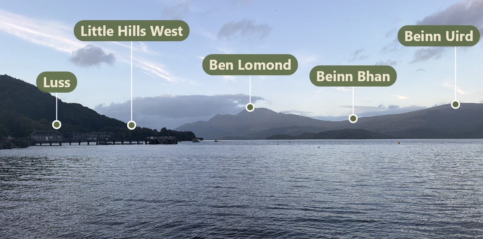
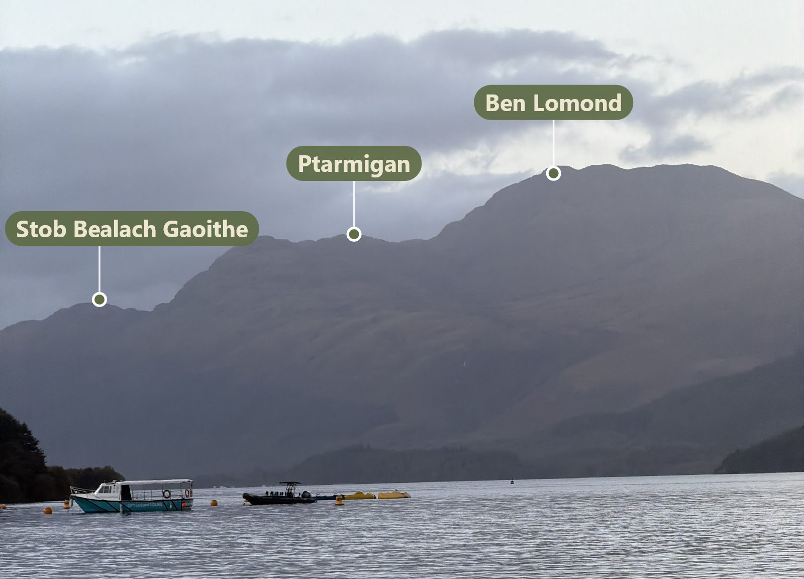
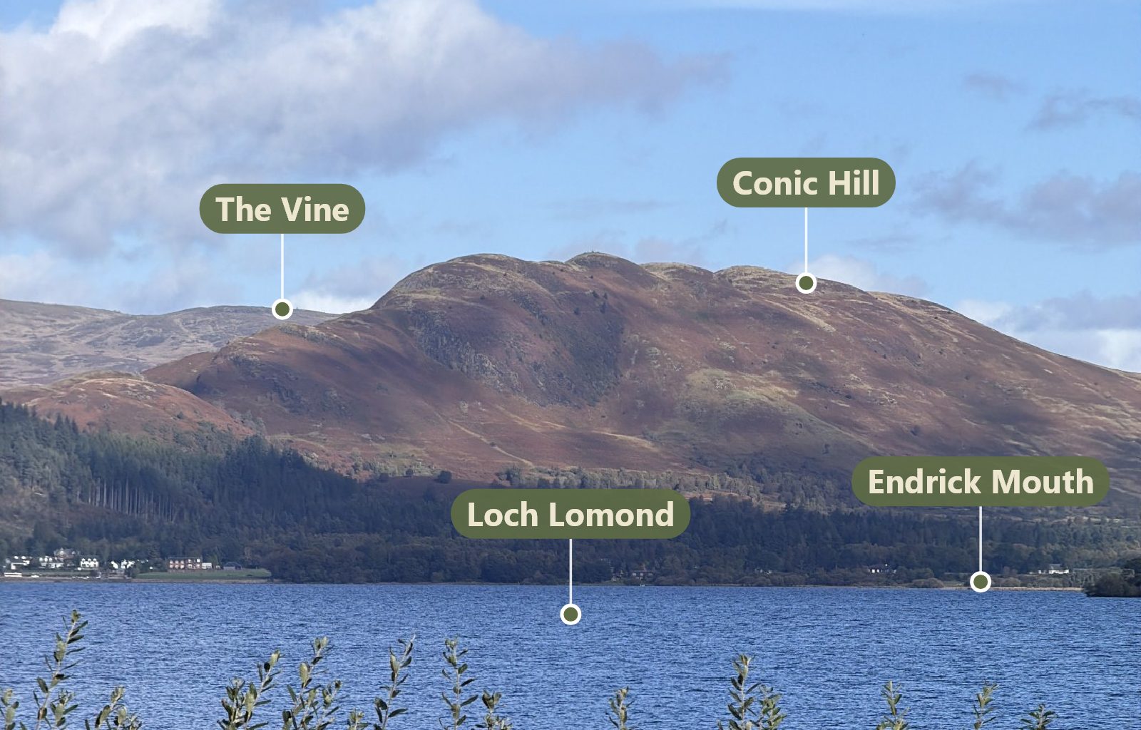
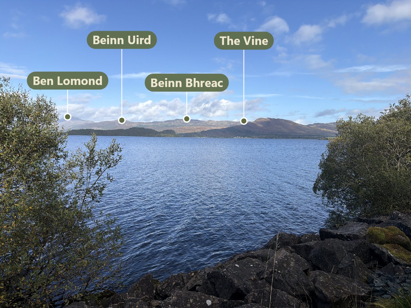
Dots mark the hills, lakes and lochs, islands and villages in your photo. Tap one for its name, height and distance, or see it on the map.
Real photos, named by View Scanner
Made for the hills
Works offline
Download the areas you visit before you go. Everything runs on your phone, so it works with no signal at all.
Great Britain
Hill country across Great Britain, built from Ordnance Survey maps and heights.
Support for the US and other countries will be added.
Your photos stay yours
Photos and your location are used on your phone and never uploaded. No adverts and no tracking.
Clouds, trees, rooftops
When only part of the skyline shows, View Scanner tells you it's unsure – and lets you line it up with a swipe.
Try it free
Every area works fully during your free trial. After that, unlock the areas you want with credits: one credit per area, yours to keep.
20 credits for £4.99
Prices may vary by country and are set in the App Store and Google Play.